A long straight road from Thurstaston village takes you down to the Thurstaston visitors centre and down to the coast and a shingle and sand beach with boulder clay cliffs overlooking the River Dee and the Dee estuary out to Liverpool Bay.
The River Dee
The Dee Estuary or in Welsh the ‘Aber Dyfrdwy’ starts near Shotton after a five-mile (8km) ‘canalised’ section and the river soon swells to be several miles wide forming the boundary between the Wirral Peninsula in England and Flintshire in north-east Wales.
The estuary is unusual in that comparatively little water occupies such a large a basin. Experts suggest that the estuary owes its origin to the passage of glacial ice south eastwards from the Irish Sea during successive ice ages, eroding a broad and shallow iceway through the relatively soft Triassic sandstones, mudstones and coal measures underlying the area. The inner parts of this channel were filled by glacially derived sands and gravels long ago but infilling by mud and silt has continued ever since. It is also thought that prior to the ice ages the estuary received larger river flows as the upper Severn flowed into the Dee near Chirk. For a period, the Mersey may also have flowed into the Dee by means of a channel which it cut through the base of the Wirral Peninsula.
The estuary is a major wildlife area and one of the most important estuaries in Britain, amongst the most important in Europe for its populations of waders and wildfowl. The Environment Agency is the Conservation Authority, and the estuary is protected or listed under several schemes.
From earliest times, the Dee estuary was a major trading and military route, to and from Chester. From about the 14th century, Chester provided facilities for trade with Ireland, Spain, and Germany, and seagoing vessels would “lay to” in the Dee awaiting favourable winds and tides. However as the Dee started to silt up, harbouring facilities developed further up the estuary on the Wirral bank successively at Shotwick, Burton, Neston, Parkgate, Dawpool, and “Hoyle Lake” or Hoylake as it is now called. The excavation of the New Cut in 1737, to improve access to Chester, diverted the river’s course to the Welsh side of the estuary, but failed to stem the silting up of the river, and Chester’s trading function declined as that of Liverpool on the River Mersey grew. However, Chester was still a major port of passenger embarkation for Ireland until the early 19th century.
Now just up the coast from Thurstaston towards West Kirby is the Dee Sailing Club with its slip way out into the estuary. The slipway is also used as an access point for cockle fishermen. A total of 53 licences are available each year to cockle fishermen with more temporary licences being issued if the cockle stock levels are high enough. However in recent years a ban on collecting the shellfish has been in place because of serious drops in cockle stocks on the Dee estuary. The industry is worth an estimated £40,000 a year to cockle pickers, who are licensed to harvest the shellfish for six months.
Thurstaston visitors centre
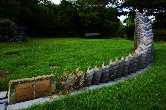
Wirral Country Park features a 12 mile footpath following the line of the old West Kirby to Hooton Railway line. At Thurstaston there is a visitor centre, Bird Hide, Toilets, Picnic Areas, BBQ area, Café, pond, Green Shop and a range of artistic pieces. The Wirral Way is very popular with pedestrians, dog walkers, horse riders and cyclists. But as well as being a stopping point on the linear Wirral Way Thurstaston is a point of access onto the West Wirral coast.

 The Birkenhead Railway, owned jointly by the Great Western Railway (GWR) and London and North Western Railway (LNWR), had initially opened a branch line from Hooton to Parkgate in 1866 with an extension to West Kirby being completed twenty years later, including Thurstaston station which opened on 19 April 1886. Station Road was constructed from land donated by local landowners Thomas Ismay and the Glegg family to provide access from the village to Thurstaston station.
During the Second World War the line was used for the transportation of munitions. Heavy anti-aircraft gun emplacements were built on land to the west of the station, which have since been grassed over.
Despite regular seasonal tourist use of the station, passenger numbers generally remained low and on 1 February 1954 the station was closed to passengers, although the line itself remained open to passenger trains for another two years. The track continued to be used for freight transportation and driver training for another eight years, closing on 7 May 1962 with the tracks being lifted two years later.
The route became the Wirral Way footpath and part of Wirral Country Park in 1973, which was the first such designated site in Britain. Unlike most of the stations on the line, the two platforms are still in situ, though the southbound platform is largely overgrown. The station buildings have long since been demolished.
Thurstaston Beach
Walking from the visitors centre you soon come to edge of the Wirral.
The west coast of Wirral is eroding and one of the best areas to view this is from the beach at Thurstaston which is constantly at the mercy of the incoming tides sent up the River Dee from Liverpool Bay. The Environmental Agency management policy agreed in the ‘Shoreline Management Plan’ is to ‘hold the existing defence line’.
The steps down to the beach directly behind the Thurstaston Visitors Centre have long gone as the ground has fallen away and the steps at the base washed away. To get onto the beach now you either take the steps down to Shore Cottage or you walk along the coastal path down to ‘Tinkers Dell’. Evidence of continuing erosion is visible here again at the bottom of the cliffs next to Tinker’s Dell. Walking through Tinkers Dell is like walking through a lush tropical jungle as you walk down to the cliffs. As you get to the beach looking at the cliffs you can see the various layers in the clay which is easily washed away by the sea.
During storms in 2013 and 2014 a disused Sandstone farm building, probably 18th or 19th century, tumbled down the cliff side onto the shore below. It’s a bit of a mystery as to what this old building was originally used for either a barn or it may have been a dwelling. However research by the Wirral Society suggests that the structure may have been a working Lime kiln from the late Nineteenth century.
Some experts suggest that the continued silting process in the River Dee will start to build a protective bank of sand which will stop the high-tides crashing onto the clay cliffs. The River Dee is in a constant state of flux with silt and the emergence of new Spartina Grass areas like those in Parkgate which has silted up dramatically since the Eighteenth Century.
A short walk back along the beach heading up the estuary towards the sea brings you to Shore Cottage.
Shore Cottage and Studio
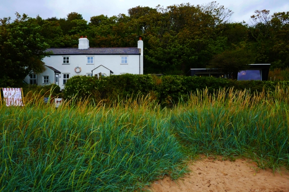
Shore Cottage Studio is a modern artists’ studio offering creative courses by the sea. The studio sits in the garden of the family home of the artists, which in turn sit right on the beach and the tidal estuary at the bottom of boulder clay cliffs in a Site of Specific Scientific Interest. The access is by a public footpath of steps with a handrail leading down the cliff onto the shore from Station Road above.
The Studio opened in 2014 and the actual building of the it featured on George Clarke’s ‘Amazing Spaces’ programme on Channel 4 in 2013. George Clark described the Studio as “the perfect place to teach art”. The studio has unrivalled, panoramic, inspirational views across to the Dee estuary to North Wales. The artists have said that it was designed and built with teaching creative courses by the sea as its raison d’être. Shore Cottage and the studio are cut off by tides twice a day, and these varying tides, open views, and as the artists say “exposure to the elements make the Cottage and its immediate environment an ever changing, exciting, dynamic, and inspirational space”. All of the courses are designed to make the most of the stunning and unique location allowing students to walk along the shore sketching, photographing, collecting and interacting with the environment. It certainly feels like a remote location well away from modern day life.


