Along the shore at Thurstaston

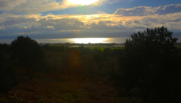
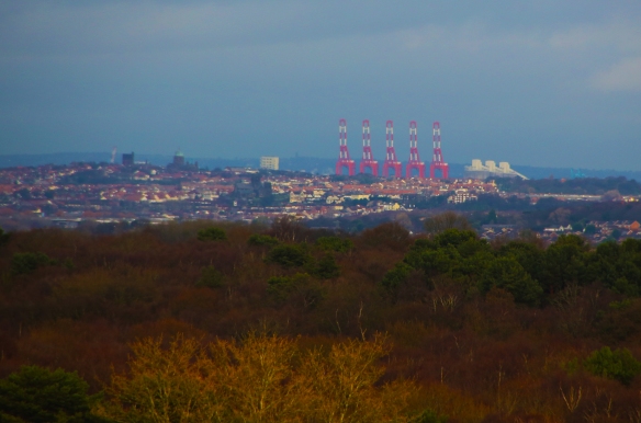
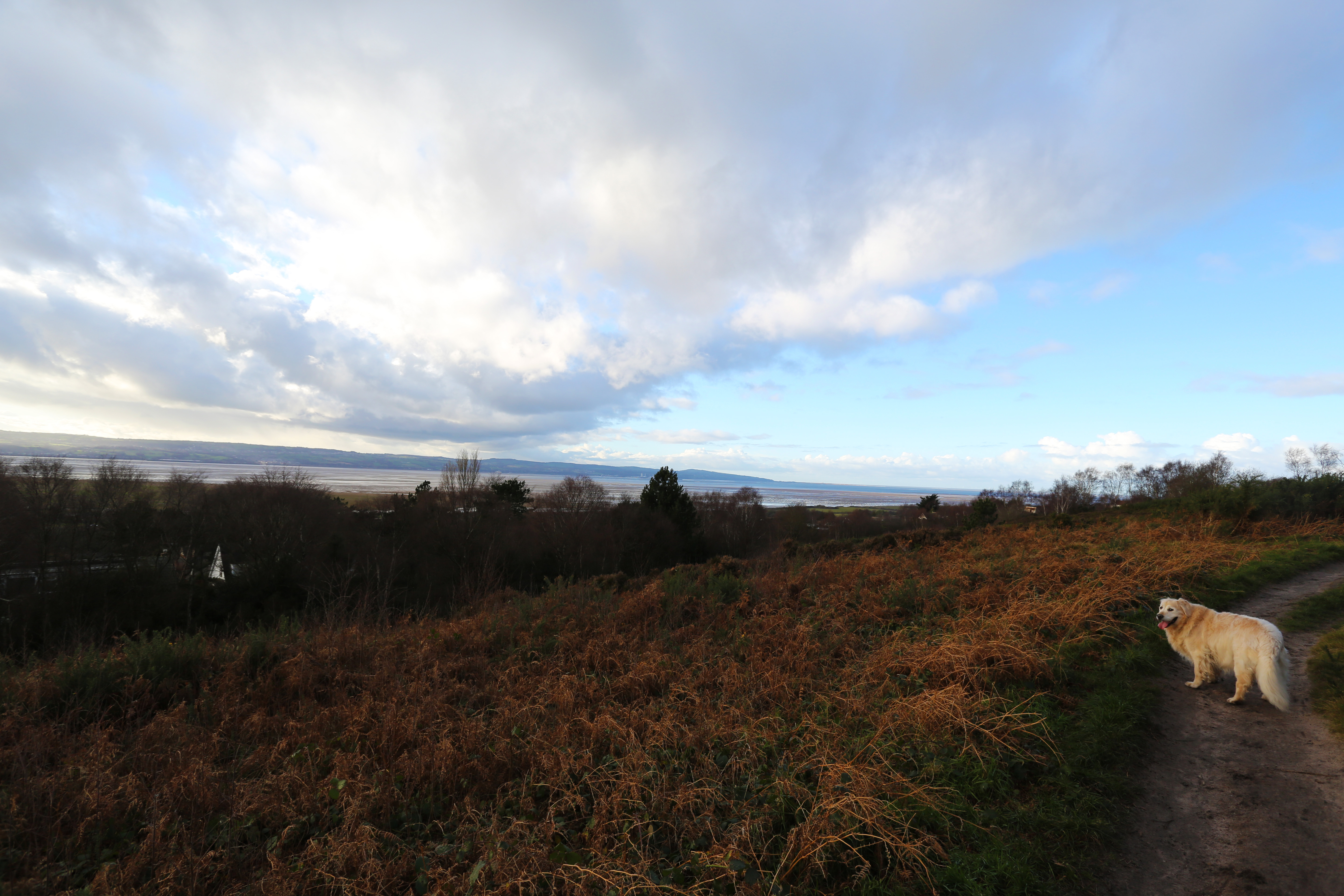
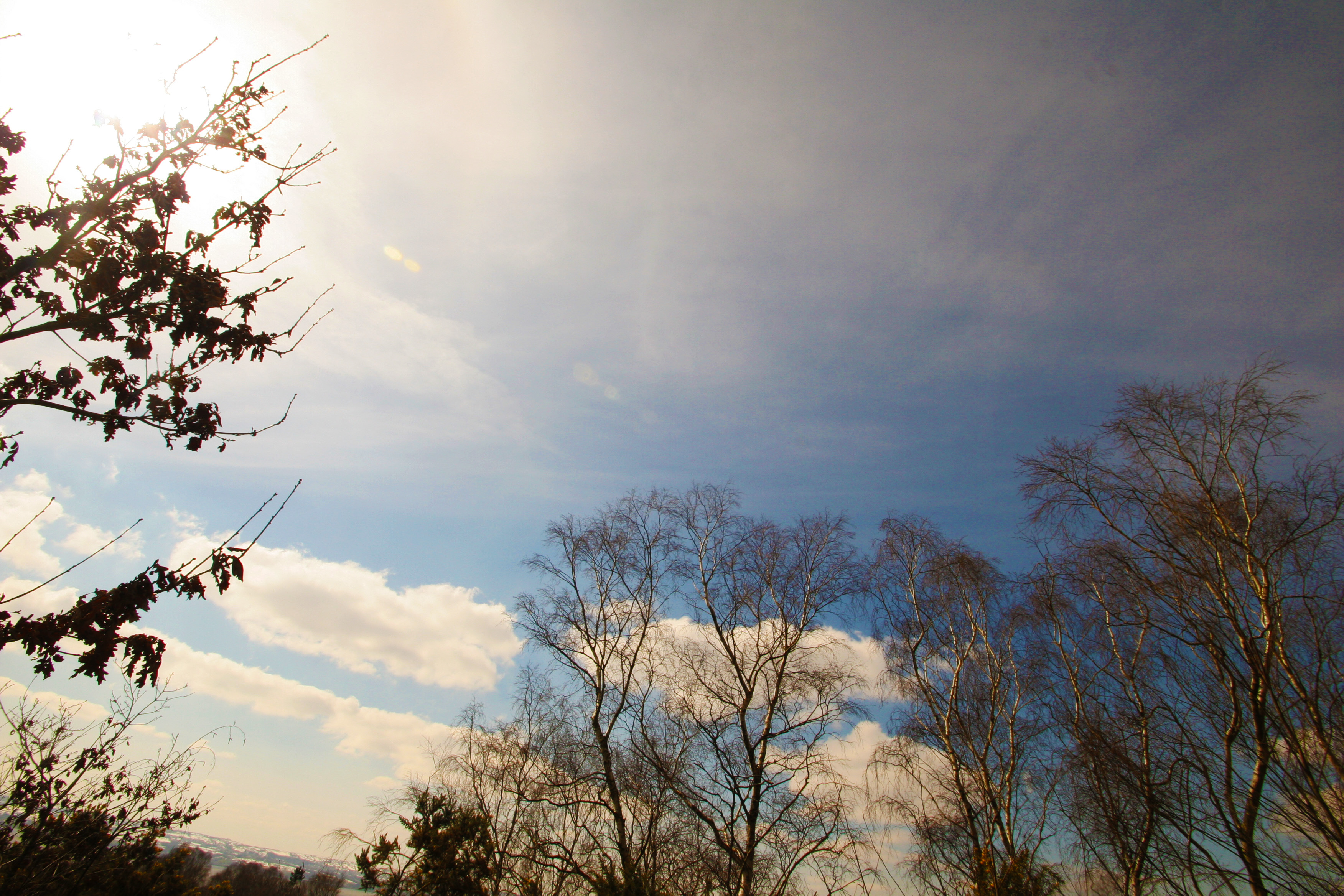
A long straight road from Thurstaston village takes you down to the Thurstaston visitors centre and down to the coast and a shingle and sand beach with boulder clay cliffs overlooking the River Dee and the Dee estuary out to Liverpool Bay.

The River Dee

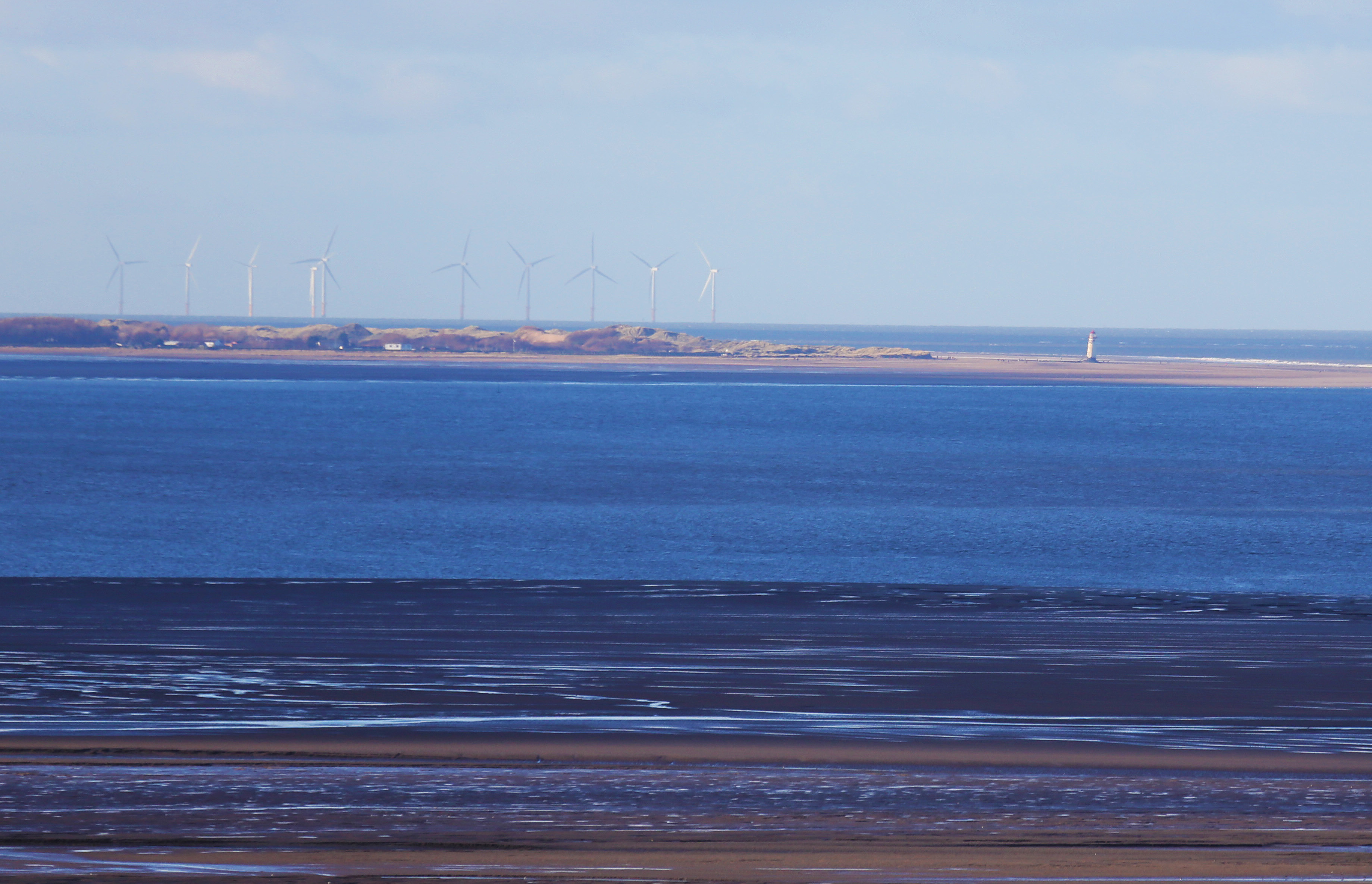
The Dee Estuary or in Welsh the ‘Aber Dyfrdwy’ starts near Shotton after a five-mile (8km) ‘canalised’ section and the river soon swells to be several miles wide forming the boundary between the Wirral Peninsula in England and Flintshire in north-east Wales.

The estuary is unusual in that comparatively little water occupies such a large a basin. Experts suggest that the estuary owes its origin to the passage of glacial ice south eastwards from the Irish Sea during successive ice ages, eroding a broad and shallow iceway through the relatively soft Triassic sandstones, mudstones and coal measures underlying the area. The inner parts of this channel were filled by glacially derived sands and gravels long ago but infilling by mud and silt has continued ever since. It is also thought that prior to the ice ages the estuary received larger river flows as the upper Severn flowed into the Dee near Chirk.  For a period, the Mersey may also have flowed into the Dee by means of a channel which it cut through the base of the Wirral Peninsula.

The estuary is a major wildlife area and one of the most important estuaries in Britain, amongst the most important in Europe for its populations of waders and wildfowl. The Environment Agency is the Conservation Authority, and the estuary is protected or listed under several schemes.

From earliest times, the Dee estuary was a major trading and military route, to and from Chester. From about the 14th century, Chester provided facilities for trade with Ireland, Spain, and Germany, and seagoing vessels would “lay to” in the Dee awaiting favourable winds and tides. However as the Dee started to silt up, harbouring facilities developed further up the estuary on the Wirral bank successively at Shotwick, Burton, Neston, Parkgate, Dawpool, and “Hoyle Lake” or Hoylake as it is now called.  The excavation of the New Cut in 1737, to improve access to Chester, diverted the river’s course to the Welsh side of the estuary, but failed to stem the silting up of the river, and Chester’s trading function declined as that of Liverpool on the River Mersey grew.  However, Chester was still a major port of passenger embarkation for Ireland until the early 19th century.

Now just up the coast from Thurstaston towards West Kirby is the Dee Sailing Club with its slip way out into the estuary. The slipway is also used as an access point for cockle fishermen.  A total of 53 licences are available each year to cockle fishermen with more temporary licences being issued if the cockle stock levels are high enough. However in recent years a ban on collecting the shellfish has been in place because of serious drops in cockle stocks on the Dee estuary.  The industry is worth an estimated £40,000 a year to cockle pickers, who are licensed to harvest the shellfish for six months.

Thurstaston visitors centre

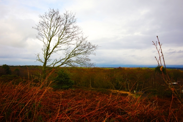
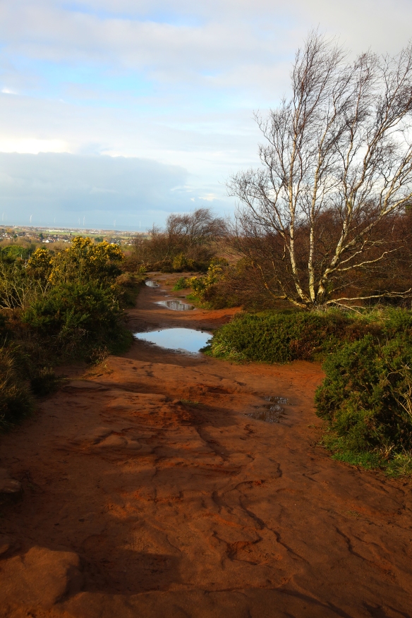
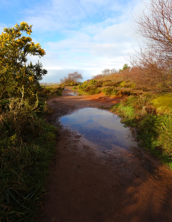
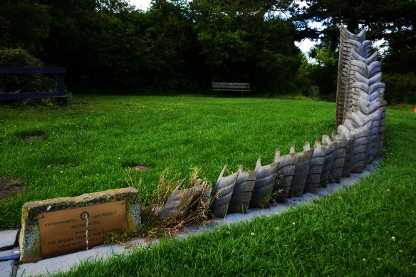
Wirral Country Park features a 12 mile footpath following the line of the old West Kirby to Hooton Railway line.  At Thurstaston there is a visitor centre, Bird Hide, Toilets, Picnic Areas, BBQ area, Café, pond, Green Shop and a range of artistic pieces. The Wirral Way is very popular with pedestrians, dog walkers, horse riders and cyclists.  But as well as being a stopping point on the linear Wirral Way Thurstaston is a point of access onto the West Wirral coast.

The Birkenhead Railway, owned jointly by the Great Western Railway (GWR) and London and North Western Railway (LNWR), had initially opened a branch line from Hooton to Parkgate in 1866 with an extension to West Kirby being completed twenty years later, including Thurstaston station which opened on 19 April 1886.  Station Road was constructed from land donated by local landowners Thomas Ismay and the Glegg family to provide access from the village to Thurstaston station.

During the Second World War the line was used for the transportation of munitions. Heavy anti-aircraft gun emplacements were built on land to the west of the station, which have since been grassed over.

Despite regular seasonal tourist use of the station, passenger numbers generally remained low and on 1 February 1954 the station was closed to passengers, although the line itself remained open to passenger trains for another two years.  The track continued to be used for freight transportation and driver training for another eight years, closing on 7 May 1962 with the tracks being lifted two years later.

The route became the Wirral Way footpath and part of Wirral Country Park in 1973, which was the first such designated site in Britain.  Unlike most of the stations on the line, the two platforms are still in situ, though the southbound platform is largely overgrown.  The station buildings have long since been demolished.
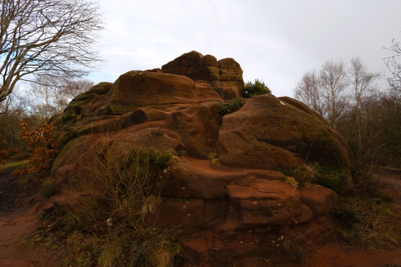
Thurstaston Beach

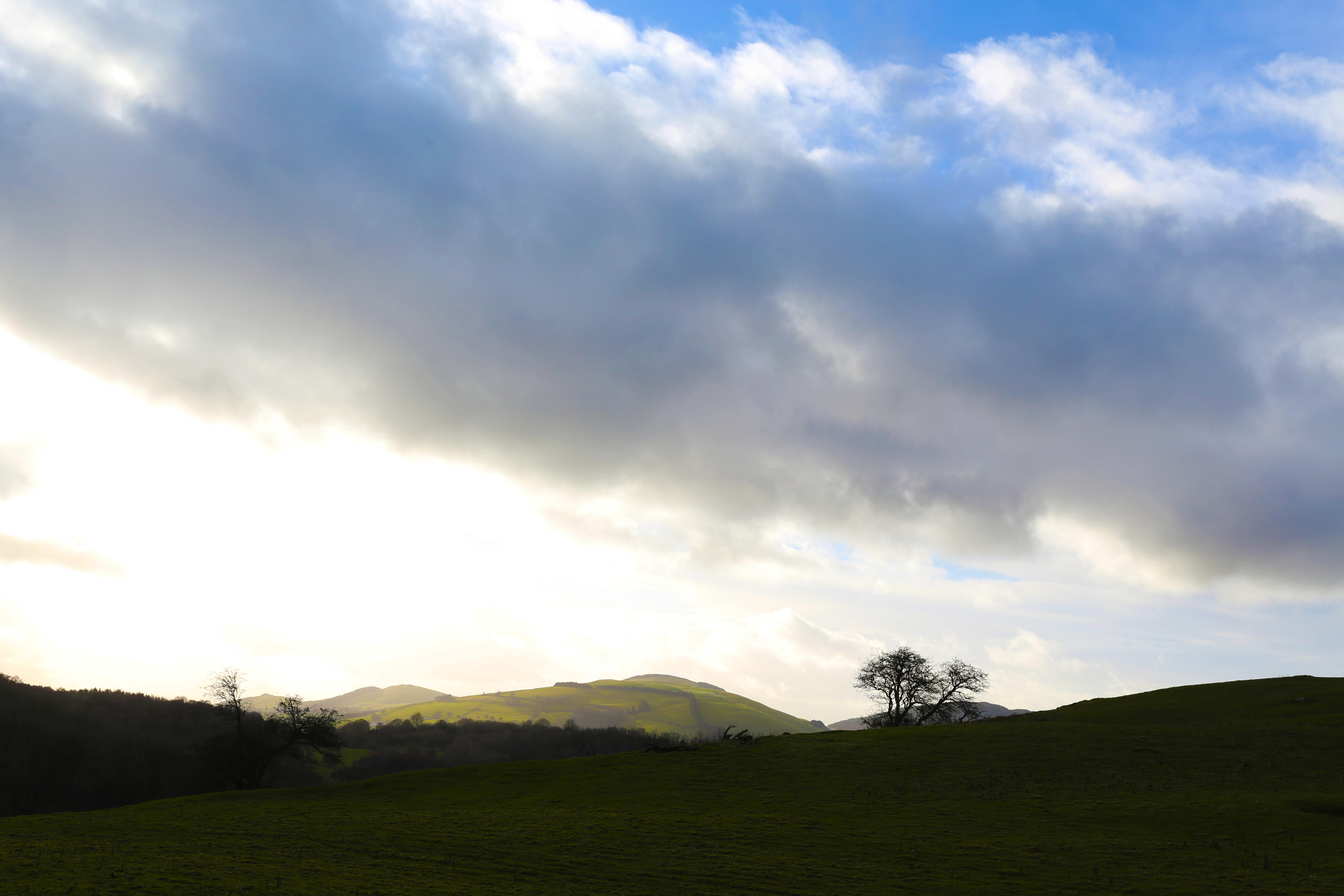
Walking from the visitors centre you soon come to edge of the Wirral.

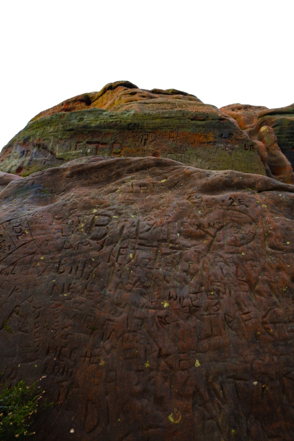
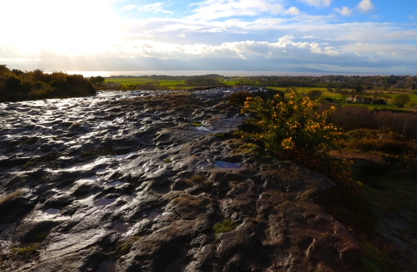
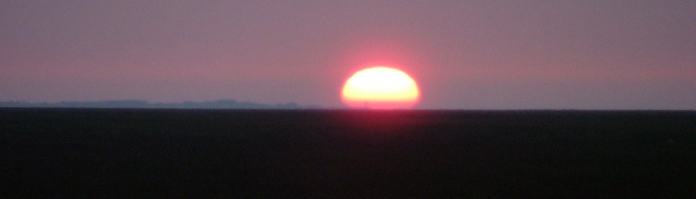
The west coast of Wirral is eroding and one of the best areas to view this is from the beach at Thurstaston which is constantly at the mercy of the incoming tides sent up the River Dee from Liverpool Bay.  The Environmental Agency management policy agreed in the ‘Shoreline Management Plan’ is to ‘hold the existing defence line’.

The steps down to the beach directly behind the Thurstaston Visitors Centre have long gone as the ground has fallen away and the steps at the base washed away.  To get onto the beach now you either take the steps down to Shore Cottage or you walk along the coastal path down to ‘Tinkers Dell’.  Evidence of continuing erosion is visible here again at the bottom of the cliffs next to Tinker’s Dell.  Walking through Tinkers Dell is like walking through a lush tropical jungle as you walk down to the cliffs.  As you get to the beach looking at the cliffs you can see the various layers in the clay which is easily washed away by the sea.

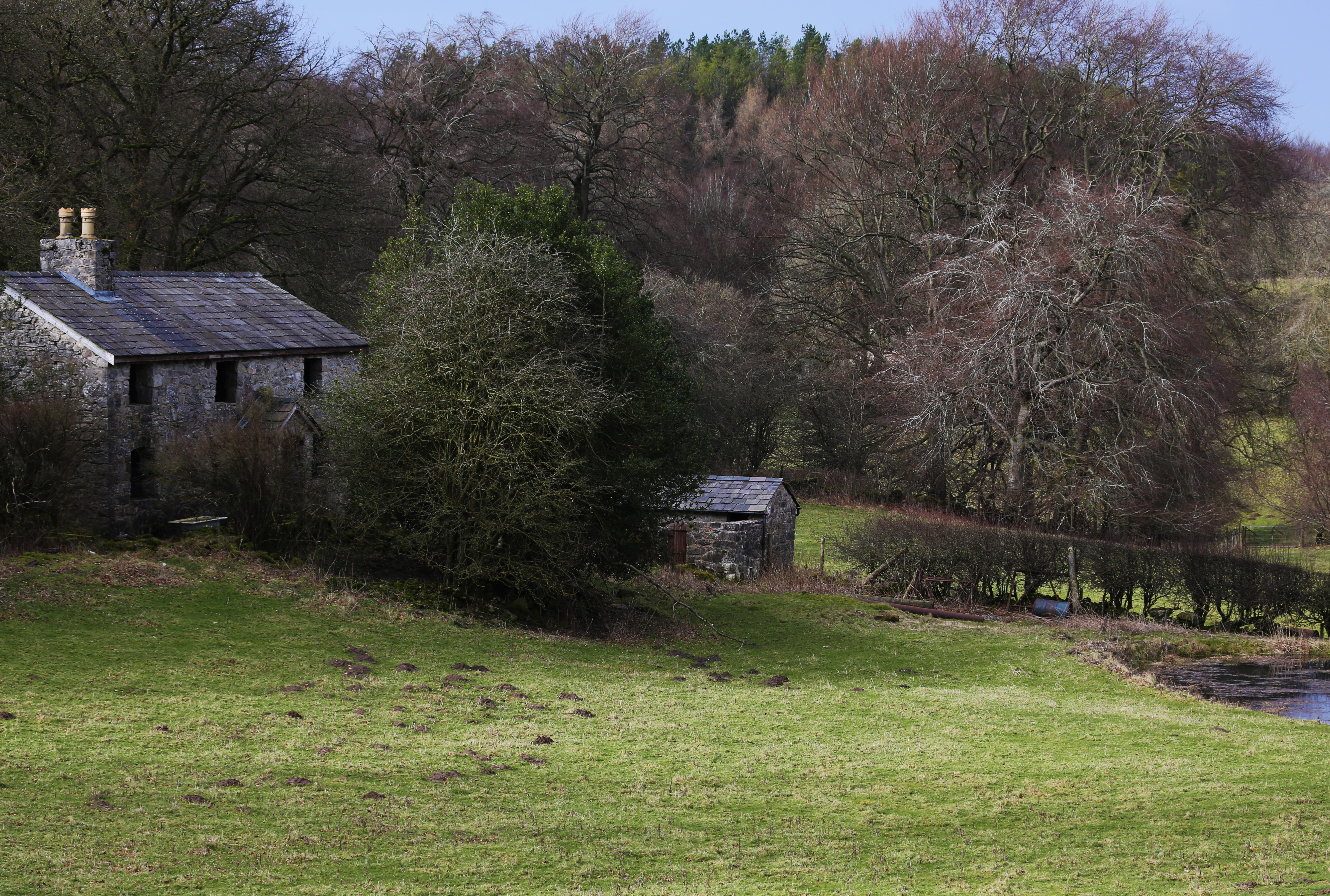
During storms in 2013 and 2014 a disused Sandstone farm building, probably 18th or 19th century, tumbled down the cliff side onto the shore below.  It’s a bit of a mystery as to what this old building was originally used for either a barn or it may have been a dwelling.  However research by the Wirral Society suggests that the structure may have been a working Lime kiln from the late Nineteenth century.

Some experts suggest that the continued silting process in the River Dee will start to build a protective bank of sand which will stop the high-tides crashing onto the clay cliffs.  The River Dee is in a constant state of flux with silt and the emergence of new Spartina Grass areas like those in Parkgate which has silted up dramatically since the Eighteenth Century.

A short walk back along the beach heading up the estuary towards the sea brings you to Shore Cottage.

Shore Cottage and Studio

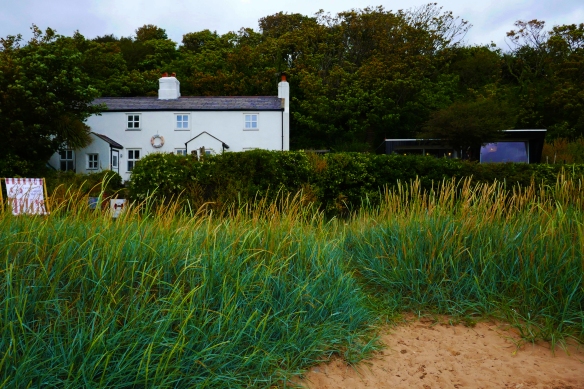
Shore Cottage Studio is a modern artists’ studio offering creative courses by the sea. The studio sits in the garden of the family home of the artists, which in turn sit right on the beach and the tidal estuary at the bottom of boulder clay cliffs in a Site of Specific Scientific Interest.   The access is by a public footpath of steps with a handrail leading down the cliff onto the shore from Station Road above.

The Studio opened in 2014 and the actual building of the it featured on George Clarke’s ‘Amazing Spaces’ programme on Channel 4 in 2013.  George Clark described the Studio as “the perfect place to teach art”.  The studio has unrivalled, panoramic, inspirational views across to the Dee estuary to North Wales. The artists have said that it was designed and built with teaching creative courses by the sea as its raison d’être.  Shore Cottage and the studio are cut off by tides twice a day, and these varying tides, open views, and as the artists say “exposure to the elements make the Cottage and its immediate environment an ever changing, exciting, dynamic, and inspirational space”.  All of the courses are designed to make the most of the stunning and unique location allowing students to walk along the shore sketching, photographing, collecting and interacting with the environment.  It certainly feels like a remote location well away from modern day life.

Around Thurstaston Common

At the weekend I walked around Thurstaston Common a part of West Wirral popular with walkers and outdoors enthusiasts.  The weather was not the best for taking photos but there was a weak winter sun in between the showers and dark clouds and foreboding skies in the late afternoon.

ok3a2946v2

ok3a3001v2

Thurstaston Common is a unique area which together with the adjacent Royden Park comprises an area of almost 250 acres (100 hectares) of parklands, woodland and natural heathland.  It is a Site of Special Scientific Interest and is a Local Nature Reserve.  The site is jointly owned by Wirral Borough Council and The National Trust and is managed by Wirral Rangers.

ok3a3009v2

ok3a2953v2

Starting from Telegraph Road you are soon at the top of Thurstaston Hill which is a modest 298 ft (91m) in height.  But it offers extensive views across the Wirral Peninsula and beyond.

ok3a2996v2

On one side there are views of the Dee Estuary (itself a Site of Special Scientific Interest) and over the River Dee to the Clwydian Hills of North Wales.

ok3a2969v2

If you look closely enough you can make out the Point of Ayr on the North Eastern corner of the North Wales coast with the Great Orme in Llandudno behind it.

ok3a2999v2

ok3a2959v2

On the other side of the Wirral peering toward Birkenhead you can see Arrowe Park Hospital in the near distance with the City of Liverpool in the far distance with both cathedrals and various city centre tower blocks being visible.

ok3a2976v2

Further round are the docks at Seaforth and the newly installed giant red cranes which are part of the new £400m Port of Liverpool terminal 2 development.

ok3a2980v2

On the third side of the peninsula are the towns of Hoylake, Moreton and Leasowe with Liverpool Bay beyond them and the wind turbines at Burbo Bank offshore wind farm at the entrance to the Irish Sea.

ok3a2994v2

The clear white painted Leasowe Lighthouse shines like a beacon but while it no longer safeguards the Wirral coast it leads the eye out to the far coast of the Mersey which extends from Crosby through to Formby Point.

ok3a2979v2

In clear weather, Snowdonia, the Pennine Hills, the Lake District are all visible but not today.

ok3a3026v2

ok3a2985v2

A brass viewfinder plate was installed on top of the Triangulation point column on the Hill in memory of Andrew Blair, founder of Liverpool and District Ramblers Association to help visitors find their bearings.  However the brass map was stolen from the viewing point in August 2016 and has not been found.  Wirral Council has promised to install a replacement plaque to be produced using photographs of the original brass map.  To this end the Council has appealed to members of the public to provide information or photographs of the original design.

ok3a3085v2

ok3a3030v2

As you approach Royden Park from Thurstaston Common you can see the Grade II listed building of Hillbark reputed to be one of the finest examples of Victorian half-timbered designed buildings. The house was originally built in 1891 for the soap manufacturer Robert William Hudson on Bidston Hill.  In 1921 the house was sold to Sir Ernest Royden, and he arranged for the house to be dismantled and rebuilt on the present site, at Royden Park, between 1928 and 1931.  Sir Ernest Royden died in 1960 and left the house to the local council and up until the mid-1980s it was used as an old people’s home.  It closed in 1984 and fell into disrepair until in the early 2000s it was converted into a five star hotel.

ok3a3080v2

ok3a3032v2

In the middle of the common is a relatively new memorial stone erected last year.  Sir Alfred Paton gave Thurstaston Heath to the National Trust in memory of his brother, Captain Morton Brown Paton and the other men of The Wirral who died in the Great War 1914-18.  Captain Morton Brown Paton served with the South Lancashire Regiment and he died in action on 7 August 1915 age 44 at Helles, Turkey.  He was a successful cotton merchant in Liverpool.   The plaque on the memorial marks the anniversary of the family’s donation to the National Trust.

ok3a3025v2

ok3a3084v2

The habitat of the Common varies from mixed woodland dominated by birches, oak, sycamore and rowan to wet and dry heathland.  Locally rare plants such as marsh gentian, oblong-leaved sundew and round-leaved sundew are found on the common. Animals include common lizard, dragonflies and birds such as yellowhammer and meadow pipit feed and nest in the heather.  Tawny owl, jay, sparrowhawk and woodpeckers can also be sighted in the pine plantations.  Today as I sat on the hill an inquisitive Robin nestling in the gorse, which was out in full bloom, was my main sighting of the local wildlife.

ok3a3095v2

ok3a3092v2

Within the Common close to Thurstaston Hill is the location of Thor’s Stone, a place of ancient legend.  Thor’s Stone is a large rectangular red sandstone outcrop that is around 50 feet in length, 30 feet wide and 25 foot high which has been eroded over thousands of years.

ok3a3060v2

ok3a3066v2

This part of Wirral was settled by the Vikings as part of a Norse colony centred on Thingwall which was the local parliament in the 10th and 11th centuries and local folklore says that the rock is named after the Norse thunder god Thor.  Viking settlers according to legend used the stone as a pagan altar when religious ceremonies were held here at Thor’s Stone.  The stone was also known locally as ‘Fair Maiden’s Hall’.

ok3a3045v2

This is a fascinating period of Wirral’s history.  The Vikings began raids on the Wirral towards the end of the ninth century, travelling from Ireland; they began to settle along the River Dee side of the peninsula and along the sea coast.  The settlement of the Wirral by the Vikings was led by Ingimund, who had been expelled from Ireland in around 902 and gained permission from Ethelfleda, Lady of Mercia and daughter of King Alfred the Great, to settle peacefully on the peninsula.  Most of the village names around the peninsula derive from ancient Norse.

ok3a3052v2

Geologists and historians now think that Thor’s stone is a natural formation similar to a tor, arising from periglacial weathering of the underlying sandstone with the rock being moulded by water flows under the ice at the end of the last Ice Age.  It was later exploited by quarrymen in the 18th and 19th centuries and weathered by subsequent erosion.  The small pool to the left of Thor’s Stone is one of the wetland areas to be found on the heath.

ok3a3046v2


ok3a3051v2

Today the soft sandstone has been an easy rock for countless people to have carved their names or messages into for posterity.  There is not an inch of it which doesn’t appear to have been carved upon.

ok3a3077v2

ok3a3048v2

The top of Thor’s Stone can be reached by a choice of easy scrambles up the heavily eroded rock. The outlines of 230 million year old sand dunes can be detected in the rock layers, a reminder that the area was an equatorial desert in the Triassic period.

ok3a3063v2

From Thor’s Stone it was a short walk back to Thurstaston Hill and back down the other side to the car park on Telegraph Road.

ok3a3014v2

ok3a3019v2

Around Rhaeadr-fawr

On Saturday we had planned a hill walk in North Wales but the weather forecast was for thunder, lightening, heavy rain and strong winds in the early part of the day clearing up by the afternoon as the weather front progressed northward.

DSCF0185v2

As we sat in the cafe in Abergwyngregyn we watched a mini torrent flowing down the street as driving rain continued to fall.  By 12.30pm we decided to brave the weather and do a less ambitious walk skirting around the head of Rhaeadr-fawr better known in English as the Aber Falls.

DSCF0183v2

It is suggested that Llywelyn the Great, one of the last native Prince of Wales who was born in 1194, held court around Abergwyngregyn.  The village’s name translates into English as ‘The Mouth of the River of White Shells’.

DSCF0178v2

DSCF0181v2

We took the path from Bont Newydd through a forest by the fast flowing Afon Rhaeadr-fawr and then a rising track along a wide span of scree around 300 feet high.  The screes are said to date from the last ice age formed following frost erosion of Bera Mawr and Bera Bach which translate as the ‘Large Haystack’ and Small Haystack’.

DSCF0207v2

DSCF0180v2

Following the scree slope the path carried on through boggy and rock scattered valleys with mosses and rough grasses.

DSCF0188v2

DSCF0186v2

Ahead of us were an expanding view of the northern Carneddau mountain range – Foel Fras, Drum, Bera Bach and Drosgl.  These are more ‘grassy’ mountains with rocky outcrops unlike many of the more rock strewn peaks elsewhere in Snowdonia.

DSCF0196v2DSCF0197v2

DSCF0193v2

Had we kept on the path you can climb all the way to the major peak of Carnedd Llywelyn some five or so miles away.

DSCF0194v2

Looking northward there were good views of the Irish Sea and the south eastern tip of the Isle of Anglesey.

DSCF0199v2

We took a bearing right crossing a number of streams draining off the hillsides and up and down over a couple of minor valleys.

DSCF0201v2

DSCF0212v2

The slopes were covered with bilberry and bracken which sapped our energy as we traversed the slopes emerging to the right of the Aber Falls or in Welsh Rhaeadr-fawr which means ‘Big Waterfall’.

DSCF0213v2


DSCF0216v2

The water falls 120 feet (36.5m) over the hard igneous rock of granophyre at Creigiau Rhaeadr-fawr.

DSCF0214v2

DSCF0221v2

By the time we got here it was the best part of the day with warm sunshine on our backs as we headed down the valley back to Bont Newydd.

DSCF0219v2

DSCF0215v2

Heswall Dales

I’ve posted about Heswall Dales before.  It’s a great place to walk in all weathers as you are rewarded with great skyscapes as well as views across to Wales or out to Liverpool Bay.

OK3A0858v2

OK3A0854v2

The Dales arean area of 73 acres of heathland and they are designated a Site of Special Scientific Interest as well as a Local Nature Reserve.  The site is red sandstone and the heathland area comprises in the main of heather, gorse and birch trees.

OK3A0862v2

OK3A0868v2

OK3A0869v2

As well as offering views of the Dee Estuary and the Clwydian Hills of North Wales you can get a clear view over to the Point of Ayr, the northernmost point of mainland Wales right at the head of the mouth of the Dee estuary. The Point of Ayr lighthouse stands on Talacre beach at this point.  At one time it had two lights; the main beam shone out to sea towards Llandudno and a second beam shone up the River Dee towards Dawpool, just below the Heswall Dales.  It was replaced by a light vessel in 1883 at which point it was retired as a working lighthouse.

OK3A0871v3

OK3A0877v2

For many years a colliery operated at Point of Ayr which was the northernmost point of the Flintshire Coalfield.  It was one of the last remaining operational deep mines in Wales extending out northwards under the Irish Sea.  However the Point of Ayr colliery closed in August 1996.

OK3A0876v2

OK3A0875v2

Now energy generation of a different kind can be seen in the distance behind the Point of Ayr headland with the Gwynt y Môr Offshore Wind Farm in Liverpool Bay off the North Wales coast.  It is currently the largest windfarm in construction anywhere in Europe.  Gwynt y Môr will consist of 160 turbines when complete.

OK3A0870v2

Moel Findeg

OK3A0914v2

Earlier in February I ventured out for a walk on the hills in North Wales to celebrate my birthday.  It was the day after a severe storm which had brought trees and some power lines down and whilst the force of the winds had dropped we didn’t venture onto the high mountains but explored a corner of the lesser known Clwydian hills.

OK3A0965v2

OK3A0964v2

The Clwydian range is only half an hour’s drive away from Wirral being located in north east Wales.  The range runs from Llandegla in the south to Prestatyn in the north dividing the valleys of the River Dee and River Clwyd, with the highest point being Moel Famau at 1,817 feet (554m).  The range is designated as an area of outstanding natural beauty.

OK3A0942v2

The summits of the Clwydian hills provide extensive views across north Wales, to the high peaks of Snowdonia, eastwards across the Cheshire Plain, Peak District and towards Manchester and Wirral and more distantly Liverpool to the northeast.

OK3A0962v2

OK3A0959v2

For this walk we started from Colomendy Outdoor Education Centre near Loggerheads on the Mold to Ruthin road and walked through woods and past old and still active quarries around the old mining village of Maeshafn.

OK3A0918v2

OK3A0917v2

Some of the paths were blocked with fallen trees and where they crossed many fields they were a quagmire of mud given the high rainfall we have had this winter.  Our lunchtime stop off point at the Miners Arms in Maeshafn had to be abandoned as the pub was closed having no electricity supply due the gales.

OK3A0922v2

OK3A0947v2

OK3A0958v2

The ‘high point’ of the walk was ascending Moel Findeg which has some extensive views for quite a small hill.  Views of Moel Famau, Foel Fenlii and Moel Eithinen can be clearly seen from the top of the hill.  The area is a local nature reserve and was saved from quarrying some years ago when local residents raised the funds to buy the site.

OK3A0946v2

OK3A0951v2

OK3A0953v2

Walking down from Moel Findeg we passed an eerie old disused farmstead before we descended back down to the valley from where we started.

OK3A0928v2

OK3A0940v2

OK3A0930v2

We arrived back to our starting point with the gentle glow of late afternoon winter sunshine.

Easter in Heswall Dales

I’ve been delayed in uploading my photos from Easter time but finally got around to it today.  On Easter Sunday it was a bright but cold morning and I ventured out onto Heswall Dales in the Wirral.

IMG_7256v2

Heswall Dales are on the north eastern side of the Dee Estuary.  They are an area of lowland heath of around seventy two acres a short distance out of Heswall town centre.  I walked through a narrow lane off Thurstaston Road behind what is now Tesco who built on the site of the old Liverpool Children’s Hospital whose grounds extended down to the Dales.  Following the path up and down over rough ground you eventually climb up onto a larger tract of open heathland.  When you get onto the higher ground you are rewarded with panoramic views of the hills and mountain ranges of North Wales across the River Dee.  Moel Famau still covered in snow could be seen clearly in the early morning haze you could just see the tip of Mount Snowden in the far distance to the left of Moel Famau.

IMG_7191v2

Over to the west sailing dinghies in the River Dee estuary could be seen with Burbo Bank offshore wind farm in Liverpool Bay in the background.

IMG_7218v2

Heswall Dales is one of the series of western lowland heath plant communities occurring on the Triassic sandstone outcrops of Wirral.  The area possesses both wet and dry heath, with birch and oak scrub, and some plant species which have a very localised presence.  Together with its associated wildlife it represents an important refuge in the ever expanding urban environment of the Wirral.

IMG_7204v2

IMG_7205v3

The heathland was recognised in 1979 as the second best remaining example of lowland heath in the Merseyside area, Thurstaston Common a bit further up the peninsula being the best regarded site locally.  The area was designated as a Site of Special Scientific Interest (SSSI) for its heathland habitat by the Nature Conservancy Council which is now known as English Nature.  In 1991 Heswall Dales was given the status of a Local Nature Reserve (LNR).

IMG_7196v2

The area has both wet and dry heathland with the dominant plant being Heather (Calluna vulgaris).  Drier areas of heath contain a mix of Bell Heather (Erica cinerea) and Western Gorse (Ulex gallii).  The gorse species is mainly distributed across the western part of Britain and is of regional significance here.

IMG_7255v2

The mixture of Birch scrub and European Gorse is an important habitat for breeding birds.  Gorse provides excellent cover for birds such as Wrens, Yellowhammers and Chaffinches.  On this morning a female Kestrel was hovering nearby its eyes fixed on its prey in the heathland below.  I stood still for some minutes and managed to get a photograph before it flew off to another part of the Dales.

IMG_7227v5

At Easter the Gorse bushes were in full flower their yellow blooms being one of the earliest flowers of the year.

IMG_7160

Heswall Dales has birch and mixed woodland in the valleys running through the site with heathland on the large broadly level area that runs though to Dale Farm at the north of the site.  The Contryside Ranger Service of Wirral Council in 2009 received funding from Natural England to carry out a restoration project to reinstate the lowland heath habitat.  They cleared the encroaching scrubland of bramble, birch and bracken which had spread and was blocking out the sunlight to the native heather and bilberry.

IMG_7168v2

In order to keep this natural habitat there is a requirement for ongoing management of the Dales and the Countryside Ranger service depend on volunteer days when members of the public help out.

IMG_7243v2

I continued to walk on to Dale End Farm Dale Farm which provides a day service for adults with disabilities and mental illness, giving people opportunities to learn life skills through the therapeutic use of horticulture.  From there I walked back onto Thurstaston Road ending my morning’s walk.

IMG_7251v2

On Moel Famau

Moel Famau (which means ‘Mothers Mountain’ in English) is the highest hill, at 1,818 feet, within the Clwydian Range of North Wales.  Moel Famau lies between Mold and Rhuthin on the border between Denbighshire and Flintshire in North Wales.

Moel Famau Country Park surrounds the hill which has been classed as an ‘Area of Outstanding Natural Beauty’ since 1985.  The park covers an area over 8 km² and is managed by Denbighshire Countryside Service.  The area is home to wildlife such as Red Grouse as well as the endangered Black Grouse, European Stonechat and Eurasian Curlew.  The area is surrounded by several well-preserved Iron-Age hill forts on the nearby hills.

The Forestry Commission manages the neighbouring forest as a sustainable conifer plantation for timber production and tourism.  There are many paths which cut through the Forestry Commission plantations which form an apron around its lower slopes.

We walked up the hill from Coed Moel Famau Forestry Commission car park.  Walking up through the plantations and past many areas that have been cleared which look like wastelands with tree stumps and timber cuttings strewn across the ground.

The paths are well used by walkers and mountain bikers and being a bank holiday weekend there were a lot of people out on the hill.

There are lots of streams flowing off the hill to feed the River Alyn.  Lower down the hill timber foot bridges allow you to cross them without getting your boots wet.

As we got higher we left the forest behind and walked up through the heather and heath land.  We then joined part of the northern route of the Offa’s Dyke National Trail to reach the summit.  Offa’s Dyke Path was opened in the summer of 1971 and links Sedbury Cliffs near Chepstow on the banks of the Severn estuary in South Wales with Prestatyn 177 miles away on the North Wales coast which could be seen to the North West of the summit of Moel Famau.  The trail is based on the dyke which King Offa ordered to be constructed in the 8th century to divide his Kingdom of Mercia from rival kingdoms in what is now Wales.

The summit can easily be seen as you ascend from any direction as you can see the large stone structure which has been built on the summit.  This is the Jubilee Tower which was built in 1810 to commemorate the golden jubilee of King George III. Designed by Thomas Harrison of Chester, it was to be an Egyptian styled obelisk, built in three stages. The tower was never completed.  In 1862 a strong storm blew it down. It was partially removed to make it safe and what you see today are the sturdy remains of the Tower.

Much of the North West of England and Wales can be seen from the summit of Moel Famau. This includes parts of Cheshire, Merseyside, Denbighshire and Flintshire. On clear days, the mountains of Snowdonia can be seen to the west and we could see the prominent mountains of Cader Idris and Snowdon in the haze today.

The Irish Sea could be seen to the north, and to the East Liverpool, Chester and Winter Hill on the West Pennine Moors near Blackburn and Bolton.  On good days you can see the Blackpool Tower but unfortunately not today in the haze.  We could see the west side of the Wirral peninsula in the middle distance from where we set off this morning and where we would return to following our descent.