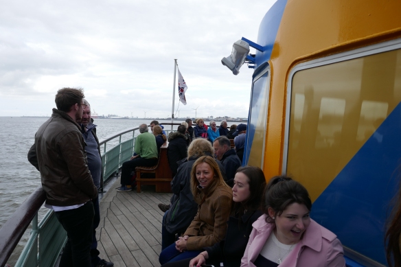
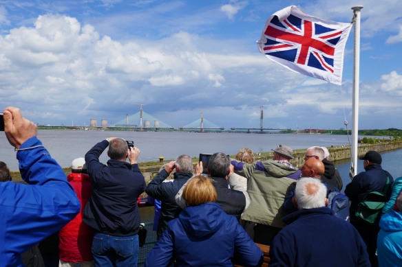
We took a trip aboard the Mersey Ferry boat the ‘Snowdrop’ which is currently painted as a dazzle ship (see my earlier blog post) on a cruise up the River Mersey and along the Manchester Ship Canal to its terminus at Salford Quays.
The Manchester Ship Canal is 36-miles long (58 km) linking Manchester to the Irish Sea. In large part it follows alongside the routes of the rivers Mersey and Irwell.
There are many landmarks along the way. There are many different types of bridges which have to be lifted or swung aside to allow ships to pass up or down the canal. As well as bridges there are many sets of locks to be negotiated. In order to travel from the tidal River Mersey the ship canal has to negotiate four sets of locks (including the entrance lock at Eastham) which lift vessels around 60 feet (18 m) up to Manchester. And on the banks of the canal there are many historic buildings and a changing industrial landscape.
The rivers Mersey and Irwell were first made navigable in the early 18th century. Goods were also transported on the Runcorn extension of the Bridgewater Canal (from 1776) and the Liverpool and Manchester Railway (from 1830), but by the late 19th century the Mersey and Irwell Navigation had fallen into disrepair and were often unusable. Manchester’s business community viewed the charges imposed by Liverpool’s docks and the railway companies as excessive and a ship canal was proposed as a way of giving ocean-going vessels direct access to Manchester. A public campaign was set up to enlist support for the scheme and was presented to Parliament as a bill in 1882. However, faced with stiff opposition from Liverpool, the canal’s supporters were unable to gain the necessary Act of Parliament to allow the scheme to go ahead until 1885.
Construction of the ship canal began in 1887 taking six years to complete at a cost of £15 million which is estimated to be equivalent to about £1.65 billion in today’s money! When the ship canal opened in January 1894 it was the largest river navigation canal in the world, and enabled the newly created Port of Manchester to become Britain’s third busiest port despite the city being about 40 miles (64 km) inland.
Changes to shipping methods and the growth of containerisation during the 1970s and 1980s meant that many ships were now too big to use the canal and traffic declined, resulting in the closure of the terminal docks at Salford in 1984. The canal is able to accommodate a range of vessels from coastal ships to inter-continental cargo liners but it is not large enough for most modern vessels. By 2011 traffic had decreased from its peak in 1958 of 18 million long tons (20 million short tons) of freight each year to about 7 million long tons (7.8million short tons).
The canal was bought by the private company Peel Ports in 1993. Peel are re-developing sites along the ship canal and are looking to increase shipping from 8,000 containers a year to 100,000 by 2030 as part of their Atlantic Gateway project.
I took a number of photographs along the route.
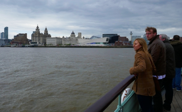
We took the ferry from Seacombe with a short hop to the Pierhead at Liverpool and down along the Mersey.
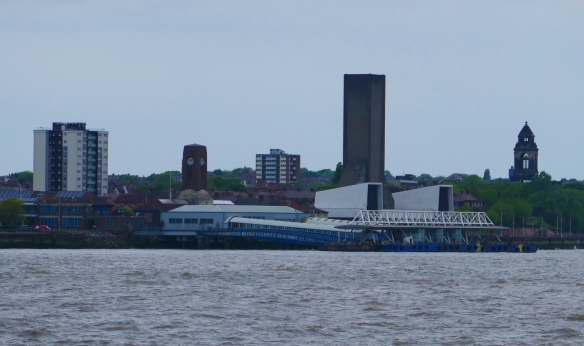


Woodside Ferry terminal in Birkenhead is the second Mersey Ferry terminal on the Wirral side. The New Brighton and Tranmere ferry terminals having long since closed down.

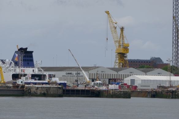
Cammel Lairds shipbuilders yard with the twelve century Birkenhead Priory building as a backdrop. I’ve posted in the past about both of these sites.

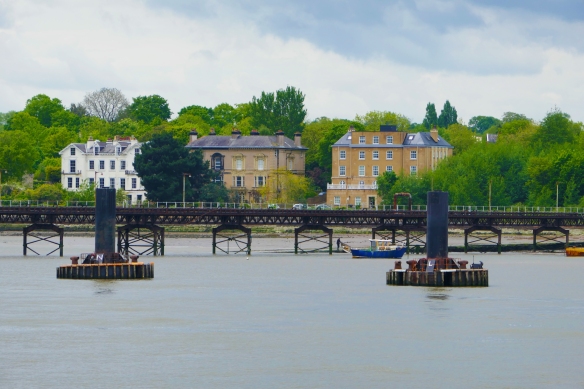
The former grand merchants houses at Rock Park on Wirral look much more elegant from the river even looking through the Tranmere Oil Terminal. Rock Park comprises a varied selection of Grade 2 listed villas built between 1836 and 1850 along with landscaped drives and a Victorian Esplanade overlooking the River Mersey. The Tranmere Oil Terminal was opened on 8 June 1960 to handle vessels of up to 65,000 tons, and is connected to the Stanlow Oil Refinery by a 15mile (24 km) pipeline. Part of the terminal occupies the site of a former ferry service to Liverpool, with the old pier considerably modified.

At Eastham locks on the River Mersey forms the entrance to the Manchester Ship Canal just after the Eastham Ferry Hotel. We passed the Sten Idun chemical tanker being navigated down the canal by the MSC tugs Victory and Viking.


At Ellesmere Port the canal is joined by the Shropshire Union Canal, at a site now occupied by the National Waterways Museum. The area was a 7-acre (2.8 ha) canal port linking the Shropshire Union Canal to the River Mersey. It was designed by Thomas Telford and it remained operational until the 1950s. I’ve posted about the boat museum in an earlier blog.


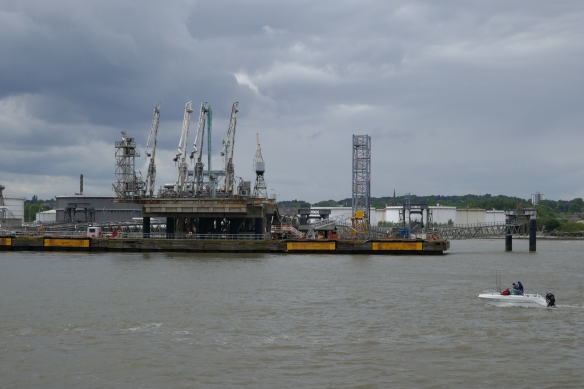
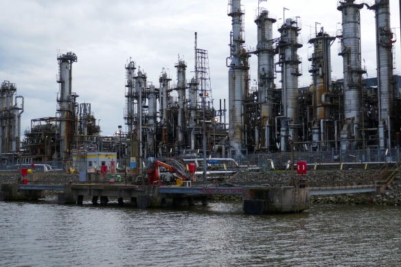
Essar Oil UK Stanlow Oil refinery is situated on the south bank of the Manchester Ship Canal, which is used to transport seaborne oil for refining and chemicals for Essar and Shell. Stanlow has a refining capacity of 12 million tonnes per year, it is the second largest in the United Kingdom and produces a sixth of the UK’s petrol needs. Stanlow is also a large producer for commodities such as jet fuel and diesel. The refinery serves much of England through the UK oil pipeline network. Oil is delivered to the Tranmere Oil Terminal via ship and pumped to Stanlow, where it is then refined and stored for delivery.


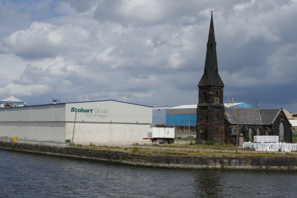
At Weston, near Runcorn, the ship canal also connects with the Weaver Navigation. Stobart Ports now own the docks at Weston Point. They are developing the site as an ‘inter-modal’ port facility to enable freight, currently carried by road, to be transported by rail and water. This will see increased warehousing, new container handling facilities, an extension to the existing West Coast main line rail siding, a new link road, and improved navigable access between the dock and the Manchester Ship Canal.

At Runcorn Ineos manufactures chemicals including chlorine, chlorine-containing compounds including vinyl chloride, heavy chemicals including alkalis, and fluorine-containing compounds. A separate business within the same company manufactures salt from brine transported by pipeline from the saltfields of central Cheshire.


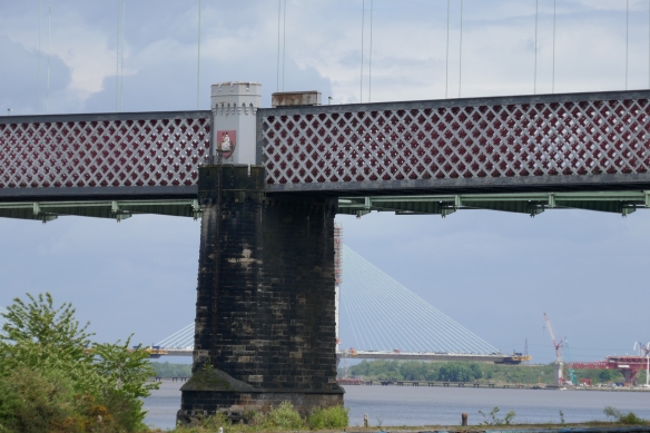
The Runcorn railway bridge is on a branch of the West Coast Main Line and provides frequent services to the Liverpool Lime Street and London Euston stations. Locally it has been called the Queen Ethelfleda Viaduct but more widely as the Britannia Bridge. The bridge is named after Ethelfleda because the southern abutments and pier were built on the site of the Saxon walled settlement built by her in 915. Parts of the bridge are castellated to reflect this. There are three shields above the footway – the Coat of Arms of the City of London, Britannia (from the crest of the London and North Western Railway (LNWR) company and the Liver Bird of Liverpool. Because of the crest the bridge is also known as the Britannia Railway Bridge.

The A533 road crosses the Runcorn Gap over the Silver Jubilee Bridge, the lowest bridge crossing of the River Mersey. It is a through arch bridge with a main arch span of 330 m. It was opened in 1961 as a replacement for the Widnes-Runcorn Transporter Bridge, and was initially known simply as the Runcorn Bridge or Runcorn–Widnes Bridge. In 1975–77 it was widened, after which it was given its official name in honour of the Queen’s Silver Jubilee. The bridge is recorded in the National Heritage List for England as a designated Grade II listed building.


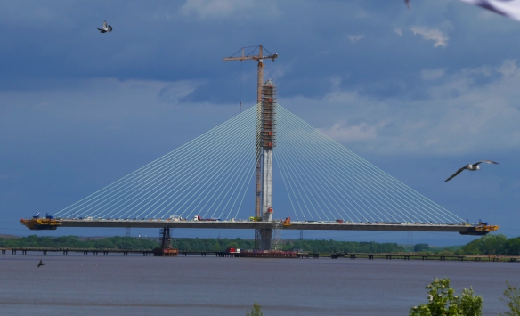
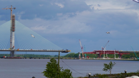
The Silver Jubilee Bridge is a bottleneck and becomes congested at peak travel times, and in the event of a breakdown or accident on the bridge, traffic in the area comes to a standstill. To resolve this problem, a second crossing of the Mersey the Mersey Gateway is now being built. Construction began in May 2014 and is due to be completed by the autumn of 2017. It is located approximately just less than a mile (1.5km) to the east of the existing Silver Jubilee Bridge that connects the towns of Widnes and Runcorn. It is will be a toll bridge, with three lanes in each direction. The design is a cable-stayed bridge with three towers across the river and a second bridge across the ship canal. It will be 2.3km long with a river span of 1km. The main bridge deck is made from reinforced concrete and the spans are supported by steel cable stays attached to pylons rising up to between 80 and 125m above the river bed.


As we move on down the ship canal we travel past a number of bridges. The construction of the Manchester Ship Canal included the construction of several swing bridges and high level bridges which would not obstruct tall vessels travelling on the Canal.
Old Quay swing bridge


Moore Lane swing bridge
 Acton Grange Railway viaduct
 Chester Road swing bridge
 Northwich Road swing bridge
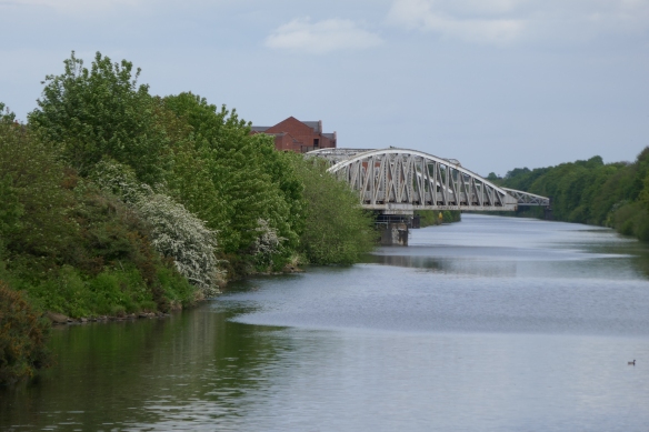
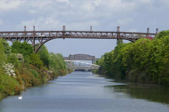
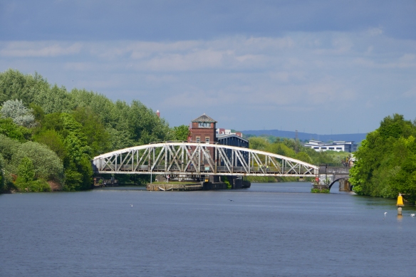
 Latchford High Level Bridge, Knutsford Road swing bridge and Latchford viaduct
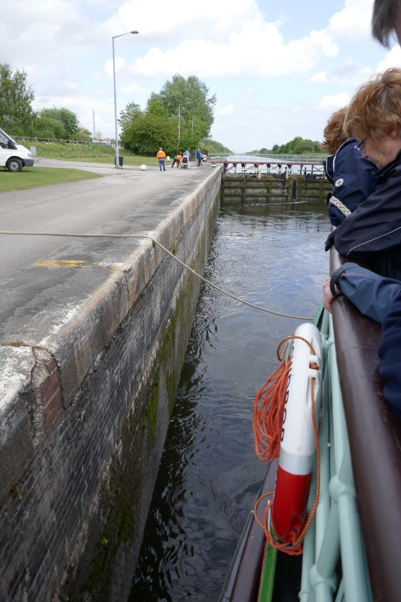
 Latchford Locks. Latchford was chosen as the location of intermediate locks on the Manchester Ship Canal. These comprise a larger lock for ocean-going vessels and a smaller lock to its south for coasters, tugs and barges. A ship mooring area was provided on the canal’s south bank and enabled two large vessels to pass each other at this point.


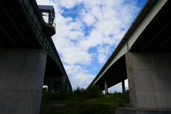
Thelwall Viaduct or officially called Thelwall High Level Bridge. The viaduct is a steel composite girder viaduct close to the village of Lymm It carries the M6 motorway across the Manchester Ship Canal and the River Mersey. It actually comprises two entirely separate bridges, one of 4,414 feet long carrying the northbound carriageway, which was the longest motorway bridge in England when it was opened in July 1963, and one 4,500 feet long carrying the southbound carriageway which was opened in 1995. The longest single span is the one of 336 feet crossing the ship canal.

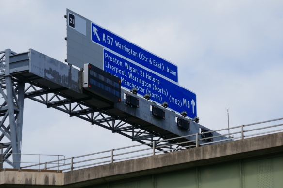
Warburton High Level Bridge. Warburton Bridge is a privately owned high-level cantilever bridge which incorporates a public highway the B5159 road, connecting the A57 with the A6144. It has a statutory toll charge of 12p. It was commissioned under the Rixton & Warburton Bridge Act 1863. It is unadopted and privately maintained. It is one of the few remaining pre-motorway toll bridges in the United Kingdom.
 Cadishead Railway Viaduct now disused
 Irlam container terminal
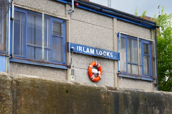
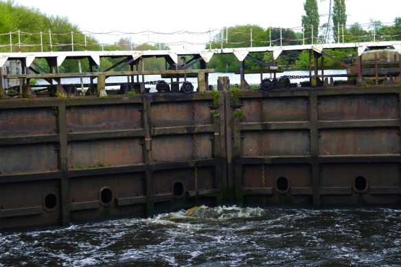
 Irlam Locks.

Barton Locks

Barton High Level Bridge carries the M60 over the ship canal. It was opened in October 1960 as part of the then M63 and was known as the Stretford – Eccles by-pass. Prior to its opening all the traffic in the area was forced to cross the Manchester Ship Canal via the Barton Road Swing Bridge or further upstream via the Trafford Road Swing Bridge. The bridge was designed of such a height to give a clearance from the water level somewhere in the region of 100 feet to allow waterborne traffic to pass freely under it. It was originally built with two lane carriageways in either direction but road traffic soon increased to the point where it became essential to widen the bridge to three lanes either side with each extra lane being supported by additional reinforced concrete piers built alongside the originals. The work on this widening process was completed in 1990 – 30 years after its original opening.

Just a little further on a 60ft lifting road bridge which was being built collapsed next to the M60 Barton High Level Bridge in May 2016. Construction was part way through the bridge which would carry a new dual carriageway over the Manchester Ship Canal to relieve congestion. The lifting platform crashed onto the canal and has subsequently been taken way leaving the four bridge towers some of which suffered damage in the collapse. The bridge’s completion has been put back indefinitely.
 Barton Road swing bridge and Barton Swing Aqueduct, the only swing aqueduct in the world. The Barton Swing Aqueduct is a moveable navigable aqueduct carrying the Bridgewater Canal across the Manchester Ship Canal. The swinging action allows large vessels using the ship canal to pass underneath and smaller narrowboats to cross over the top. The aqueduct, is a Grade II listed building and is considered a major feat of Victorian civil engineering. It was designed by Sir Edward Leader Williams and built by Andrew Handyside and Company of Derby, the swing bridge opened in 1894 and remains in regular use.
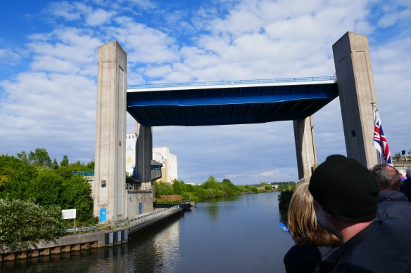
 Centenary Lift Bridge is the last bridge that we sail below as we then enter into the Salford Quays complex.
 We then pulled into a side dock just before the ITV studios. Media City is well named given the number of broadcasting satellite dishes next to our disembarkation point.


 The trip had taken us over six hours passing through a varied landscape and a history of our industrial past and present.